
Forensic Surveys & Accident Reconstruction
Accurate surveys of accident locus are a prerequisite whenever liability is challenged and as Land and Chartered Engineering surveyors we are experienced in the provision of accident surveys and Expert Witness reports.
 Not
only can we provide a full survey of the scene in traditional 2d plan form but
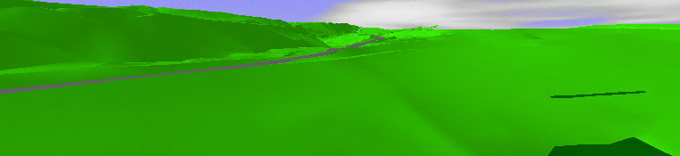
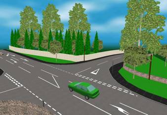
we can also create rendered VRML models of the location which can produce 3d
views from any position. Need to see what the driver saw?
Not
only can we provide a full survey of the scene in traditional 2d plan form but
we can also create rendered VRML models of the location which can produce 3d
views from any position. Need to see what the driver saw?
No problem!
The 3d models are fully interactive, (we supply a 3d viewer) to allow the
instructing solicitor or others can "wander the location at will " and
uniquely, by using the very latest accident reconstruction software we can
also animate the scene to fully recreate the accident. The client can then view
the accident "as it happened" in real time over and over if required. 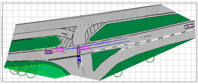
The survey will of course be carried out by a professional and
experienced surveyor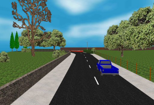 who has experience in this type of forensic mapping using the latest optical or satellite
based surveying equipment as appropriate.
who has experience in this type of forensic mapping using the latest optical or satellite
based surveying equipment as appropriate.
The report is prepared in accordance with the RICS practice statement "Surveyors acting as Expert Witness Second Edition" to a format approved by the Academy of Experts.
We understand the need for the survey and report to be prepared and made available as quickly as possible and we strive to be totally professional and transparent in respect of all our dealings.